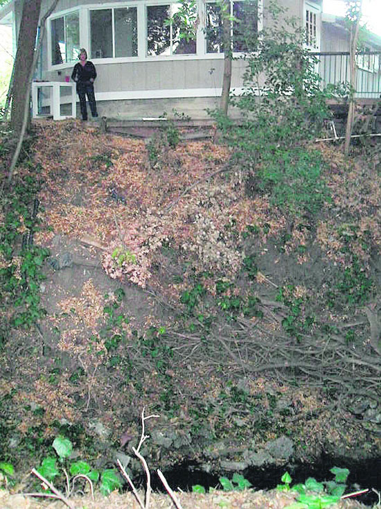
View of Lynn Perry's home and adjacent creek Photo Cathy Tyson
Lynn Perry is a woman with a mission. After receiving a letter from her mortgage holder telling her she was required to get more flood insurance, yet none of her immediate neighbors' homes that back up to the same creek got a similar letter, she figured something was wrong. Imagine her surprise when the quote for the new flood insurance turned out to be more than $2,300. After contesting the matter, and proving the elevation of her home was clearly above the creek that runs next to her property on Old Tunnel Road, she got her new insurance down to just $300 per year.
The Federal Emergency Management Agency (FEMA) periodically updates flood maps to show areas with a one percent chance of flooding each year - also known as100-year floodplains. The most recent update placed some homes in flood-prone areas. Flood insurance is mandatory for residential, commercial and industrial developments within a Special Flood Hazard Area or floodplain.
"While alerting people who could be a flood risk seems okay, these maps are not accurate and not useful. The burden of proof was on me to prove we were not in a flood zone as the map indicated," said Perry.
In the case of Ms. Perry, FEMA determined that only the northwest corner of her property was found to be in a flood zone. Rather unusual since the entire side of her one-story home backs up to a creek. She ended up hiring a civil engineer and a land surveyor to prove her case, submitted documentation to FEMA and her insurance company. Only when all of the requirements were satisfied were her premiums significantly reduced.
Perry is currently helping homeowners in Concord and Pleasant Hill. "I would like to help anyone with a similar problem," she said. "This problem is nationwide and many communities have class action law suits with FEMA and their counties."
Part of the solution in contesting flood zone issues is obtaining a "base flood elevation" certificate by a surveyor. Matt Luttropp, Associate Engineer with the City of Lafayette, suggests if a number of adjacent homeowners wanted to share the cost of retaining a surveyor to document the base flood elevation - homeowners, "May be able to dramatically reduce costs." He also said residents who own a large parcel of land that has a creek running through the lower portion, but the home is located significantly higher up a hillside could argue for reduced risk designation. For more information, go to www.floodsmart.gov, or call a FEMA Map Specialist at 1-877-FEMA-MAP (1-877-336-2627. Lynn Perry can be reached via e-mail at lynnperry56@gmail.com.