|
|
Published February 26th, 2014
|
MOFD Updates GIS Evacuation Maps
|
| By Cathy Dausman |
 |
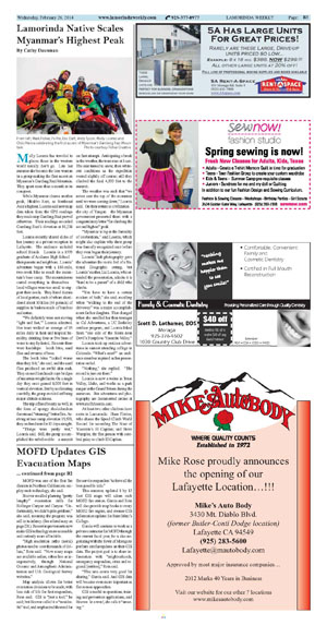
| Uriel Garcia and Dennis Rein discuss evacuation routes in Orinda's Sleepy Hollow neighborhood. Their map is a print version of the GIS overlay system they are building. Photo Cathy Dausman |
Usually residents want to get into their neighborhood, but there are times, and situations, where the goal is getting out. A flood, wildfire or hazardous material spill may make a neighborhood uninhabitable and evacuation imperative. This is why the Moraga-Orinda Fire District is utilizing computer technology to pre-plan local evacuation routes. The goal is to update the MOFD area GIS, or geographic information system, allowing first responders to identify safe exit routes and trouble shoot traffic control "choke points" - potential traffic jam locations - ahead of a real disaster, said Emergency Preparedness Coordinator Dennis Rein.
 In 2013, Rein and MOFD intern Uriel Garcia worked to electronically note the location of the area's every fire hydrant, fire trail, and street. Garcia also uploaded parcel map information, the location of Central Sanitary (sewer) lines, East Bay Municipal Utility District water lines, local creeks, streams, and other hazards. Gas main information from PG&E is yet to be added. In 2013, Rein and MOFD intern Uriel Garcia worked to electronically note the location of the area's every fire hydrant, fire trail, and street. Garcia also uploaded parcel map information, the location of Central Sanitary (sewer) lines, East Bay Municipal Utility District water lines, local creeks, streams, and other hazards. Gas main information from PG&E is yet to be added.
The job was a good fit for Garcia, who describes himself as "a big picture kind of guy."
This information, and much more, can be layered into the GIS system, the way celluloid pages built the "visible man" in printed reference books. Each layer can be turned on or off as needed. To illustrate GIS use, Garcia showed how a simulated fire might grow from the Bear Creek trail - along the shore of Briones Reservoir - and progress south toward Orinda's Sleepy Hollow School. The location was picked because Sleepy Hollow neighborhood will soon become one of Contra Costa County's first Firewise (wildfire community preparedness, www.firewise.org) communities.
"“GIS is a lifestyle program; it needs to be kept up,” Rein said. MOFD started its evacuation route mapping back in 2005-06 under then fire marshal Tonya Hoover, who is now the California state fire marshal. She said the initial effort was tied into the Cal Fire efforts on wildfire data mapping with data layers intended for use by fire service responders.
MOFD was one of the first fire districts in Northern California to employ such technology, she said.
Hoover recalled planning "pretty lengthy" evacuation drills for Bollinger Canyon and Canyon. "Unfortunately, we didn't quite get there," she said, meaning the program was still in its infancy. (See related story on page D1.) Recent improvements now make GIS technology more accessible and certainly more affordable.
"High resolution ortho (aerial) photos used to cost thousands of dollars," Rein said. "Now many maps are available online, either free or inexpensively, through National Oceanic and Atmospheric Administration and U.S. Geological Survey websites."
Map analysis allows for better evacuation decisions to be made, with less risk of life for first responders, Rein said. GIS is "just a tool," he said; but Hoover called it a "wonderful" tool, and emphasized the need for fire service responders "to have all the best possible info."
This summer, updated 8 by 12 foot GIS maps will adorn each MOFD fire station. Garcia and Rein will also provide map books to every MOFD fire engine, and oversee GIS information updates for Saint Mary's College.
Garcia will continue to work as a private contractor for MOFD through the current fiscal year; he is also negotiating with the Town of Moraga to perform similar updates on their GIS data. The project goal is to share information with "neighborhoods, emergency responders, cities and regional [entities]," Rein said.
"This area seems very good for sharing," Garcia said. And GIS data will become even more important as fire season approaches.
GIS is useful in operations, training and prevention applications, said Hoover. In a word, she calls it "amazing."
|
|
|
|
|
|
|
|
|
|
|
|